PROJECT DESCRIPTION
IMLab is a project of UCLA REMAP in partnership with California State Parks that utilizes emerging digital technologies and research to explore and interpret the Los Angeles State Historic Park (LASHP).
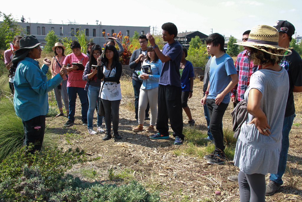
For their summer 2012 IMLab project, UCLA REMAP subcontracted Public Matters to run a six-week workshop for L.A. high school students. The project was in partnership with California State Parks with support from UCLA’s Center for Embedded Network Sensing (CENS).
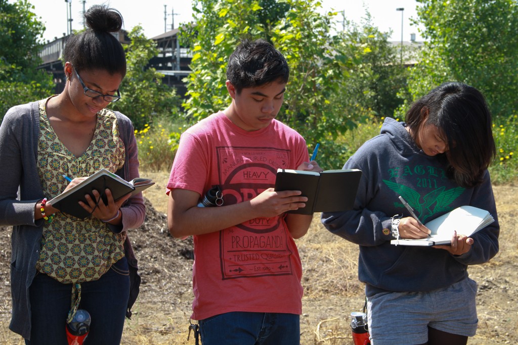
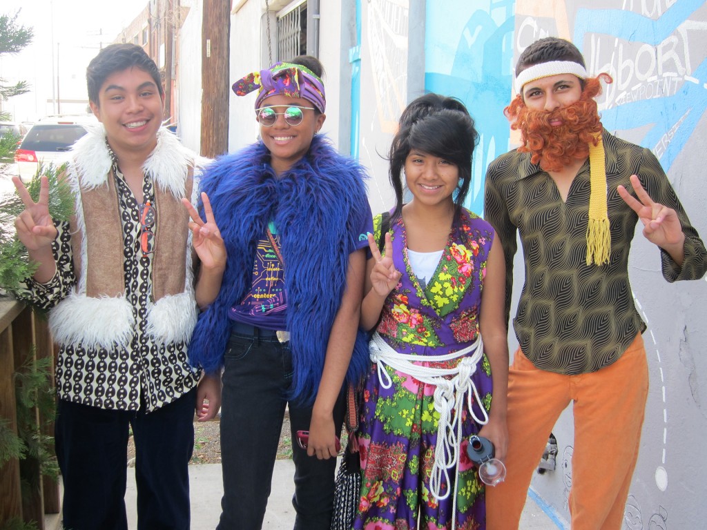
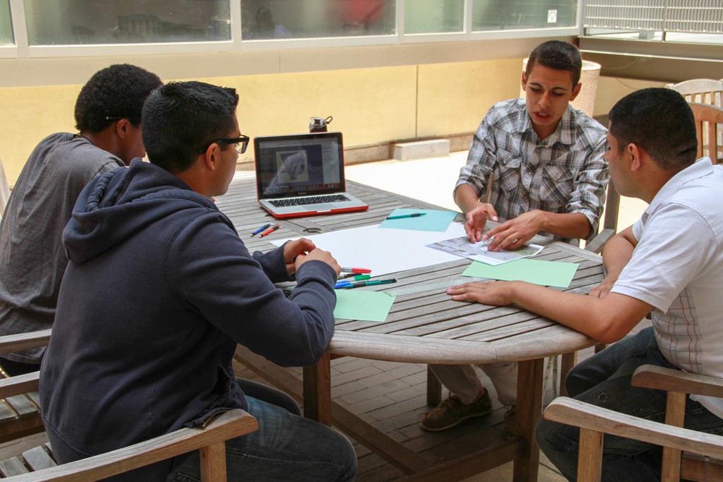
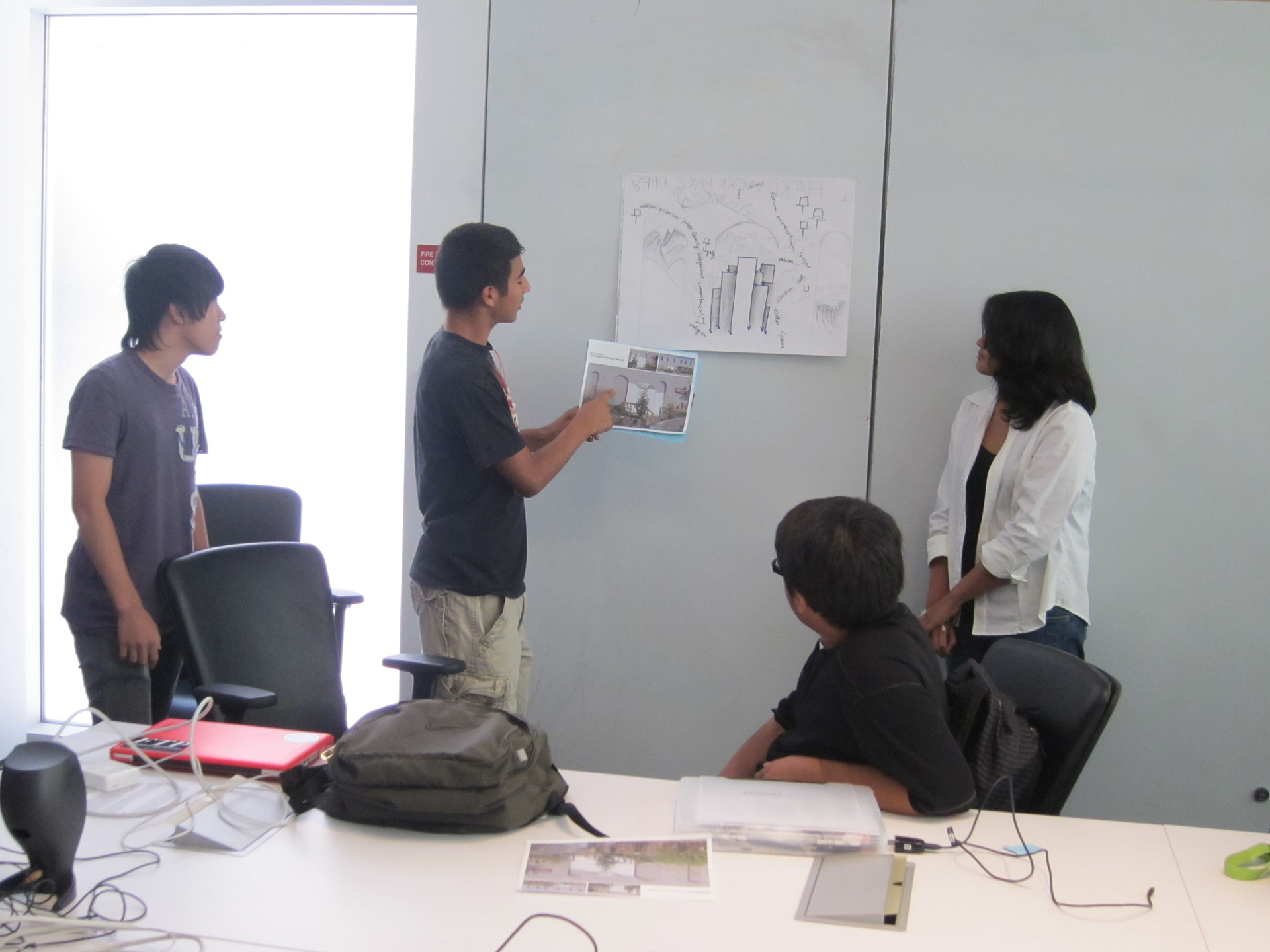
A select group of Los Angeles 10-12th graders were hired to be part of IMLab Summer 2012. Through research, data analysis and visualization, mobile technologies, art, and media production, they explored LASHP. They focused on LASHP’s history, geography, ecology, culture, and that of adjacent neighborhoods. The program connected students to the scientific method and to the arts. It trained them to use creative visual skills in combination with research and analysis to produce, interpret, and present narratives of place and community through mobile technology and media.
Public Matters Role

Public Matters developed the Summer Workshop’s curriculum and implemented the program.
Public Matters worked closely with UCLA REMAP and special guest collaborator artist Christina Ree to develop and implement the project’s place-based curriculum. The iterative educational framework offered a symbiotic relationship between research, data-driven capture and analysis and visual, creative projects.
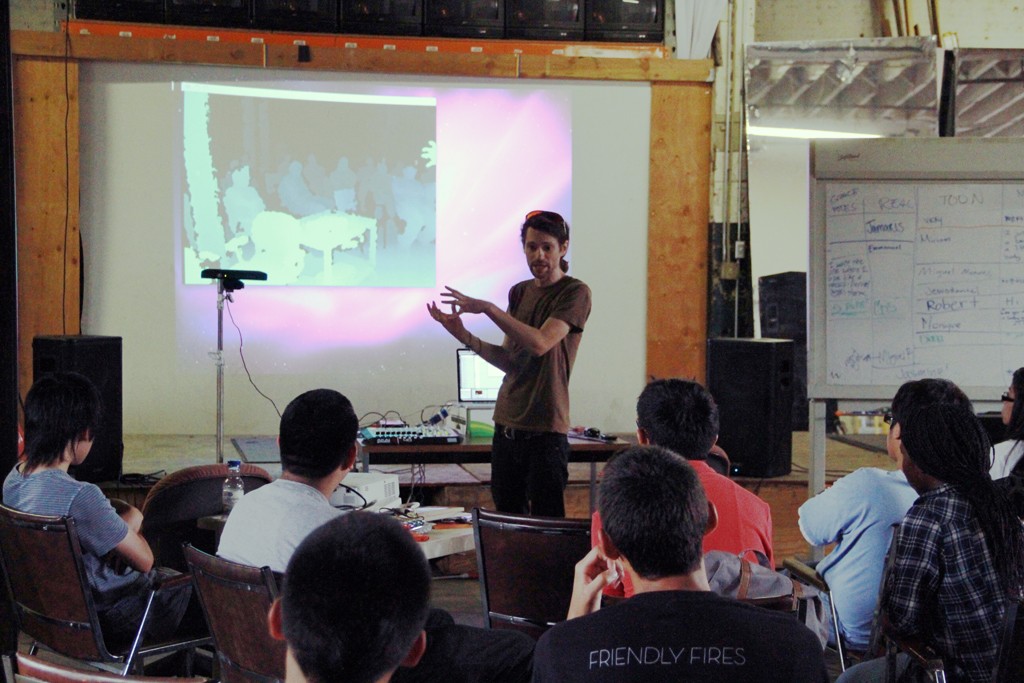
Public Matters led the workshops, working with Christina Ree and James Dellemonico and Taylor Fitz-Gibbons from UCLA REMAP. Workshops were held at IMLab, which is adjacent to LASHP, and CENS at UCLA.
CONTEXT
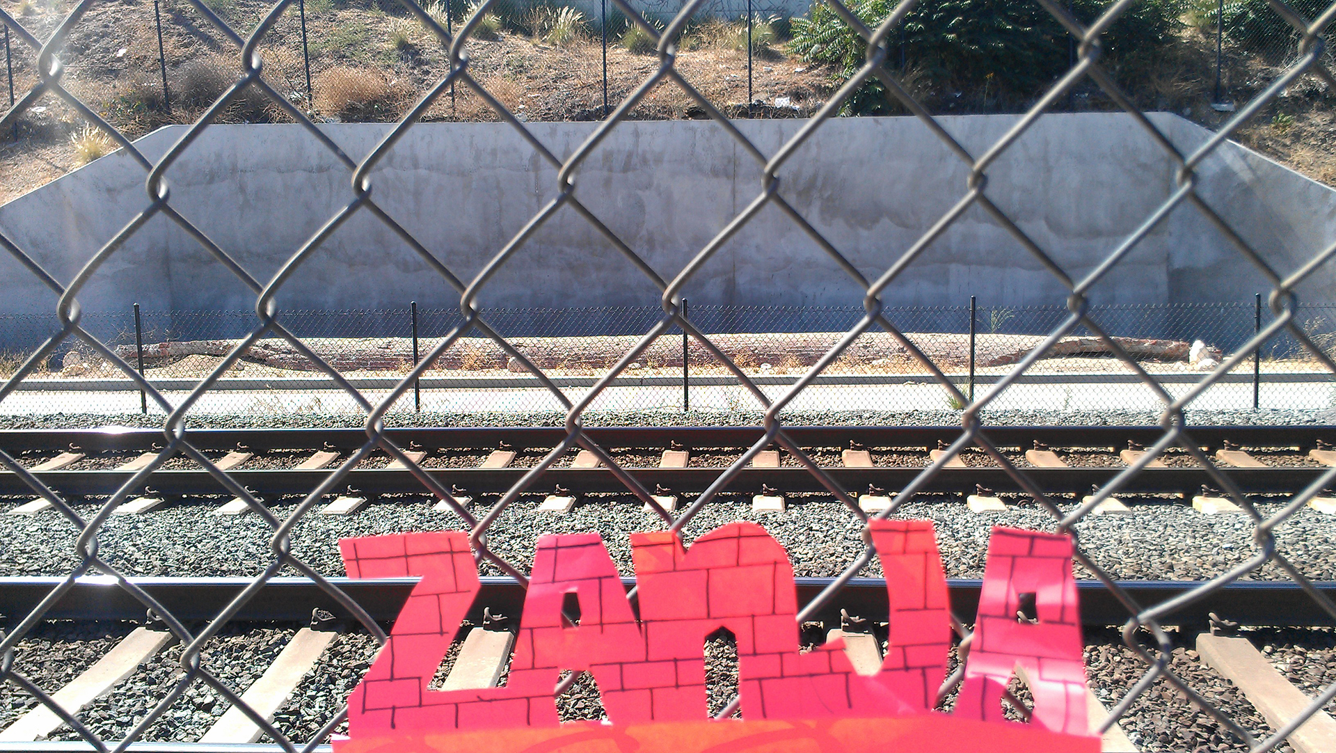
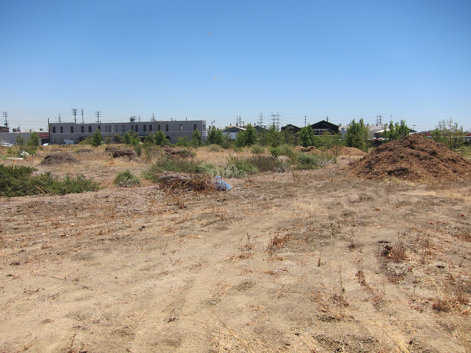
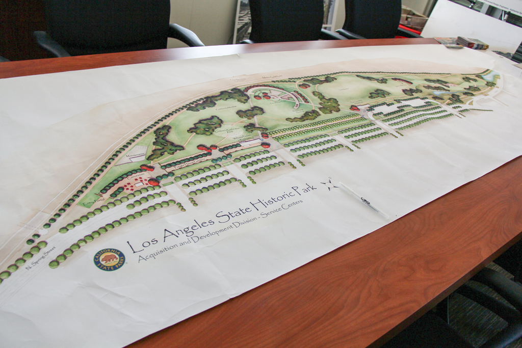
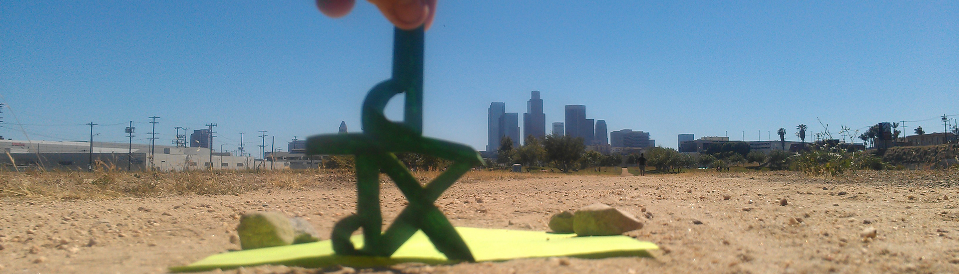
In many ways the City of Los Angeles grew out of the site that is now the Los Angeles State Historic Park (LASHP). Native communities settled there, drawn by the adjacent Los Angeles River. The Zanja Madre, or “Mother Ditch,” Los Angeles’ original aqueduct ran through, bringing water to the nearby Pueblo de Los Angeles. River Station, Los Angeles’ first railroad yard, was built on-site. Standard Oil’s first refinery was nearby. Industry, engineering, transportation, immigration and migration patterns that explain much of Los Angeles’ formative development can be traced in and out of LASHP. LASHP is also an anomaly. At the time of the IMLab Summer 2012 program it was a largely undeveloped 21st century urban park that was formed thanks to grassroots activism, sitting in the midst of several neighborhoods. History is front and center in its name, yet one would be hard pressed to find that history on-site without a guide. This presented a unique scenario for a cross-disciplinary project to explore its history using cutting-edge technology, and use interpretive methods, art and visual strategies to make LASHP’s history visible.
GUEST INSTRUCTORS
In an effort to expose students to a variety of career and educational pathways and to tap into a vast network of knowledge and wisdom, the summer workshops featured an all-star lineup of guest instructors:
John Arroyo, Urban Planner and Community Historian – Neighborhood History
Olivia Chumacero, Native American History – Culture and Ecology
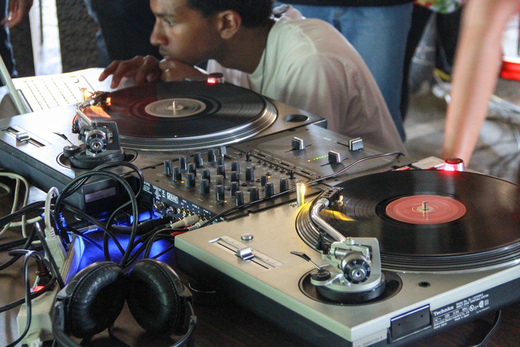
Majorie Light, DJ – Beat Making
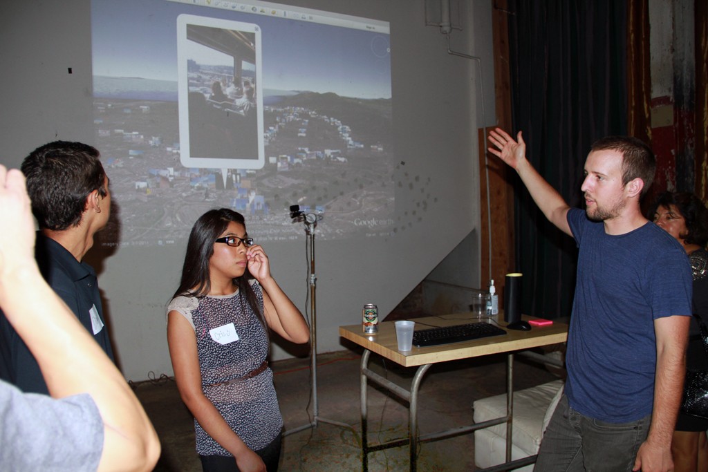
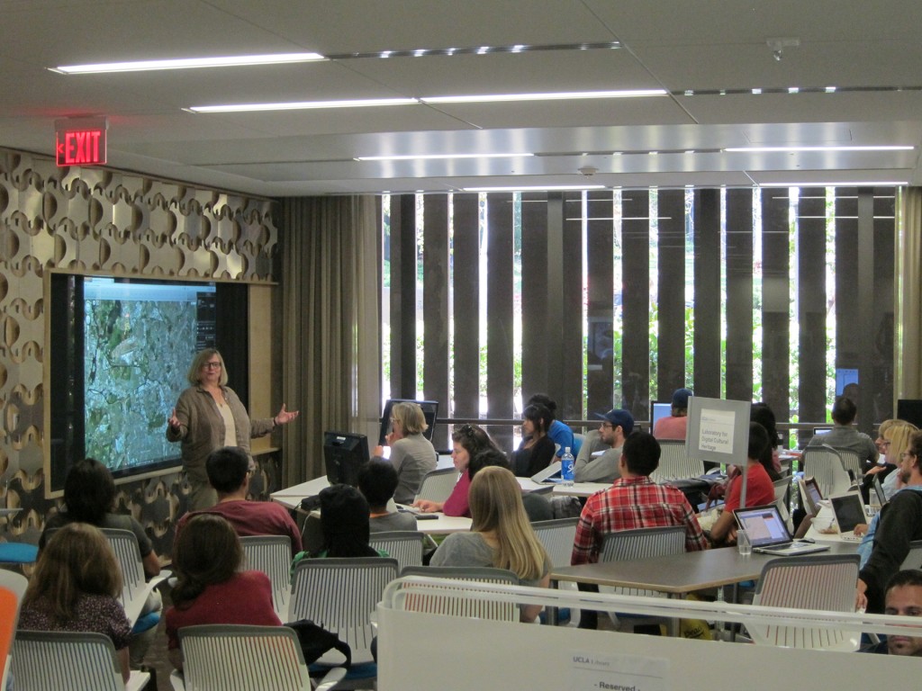
Amelia McNamara, UCLA CENS – Data Capture and Analysis
James Newland, CA State Parks Historian – Transportation and Migration Patterns
UCLA Professors Jan Reiff and David Shepard – Digital Mapping using HyperCities
Rosten Woo, Artist/Designer – Data Visualization for Social Change
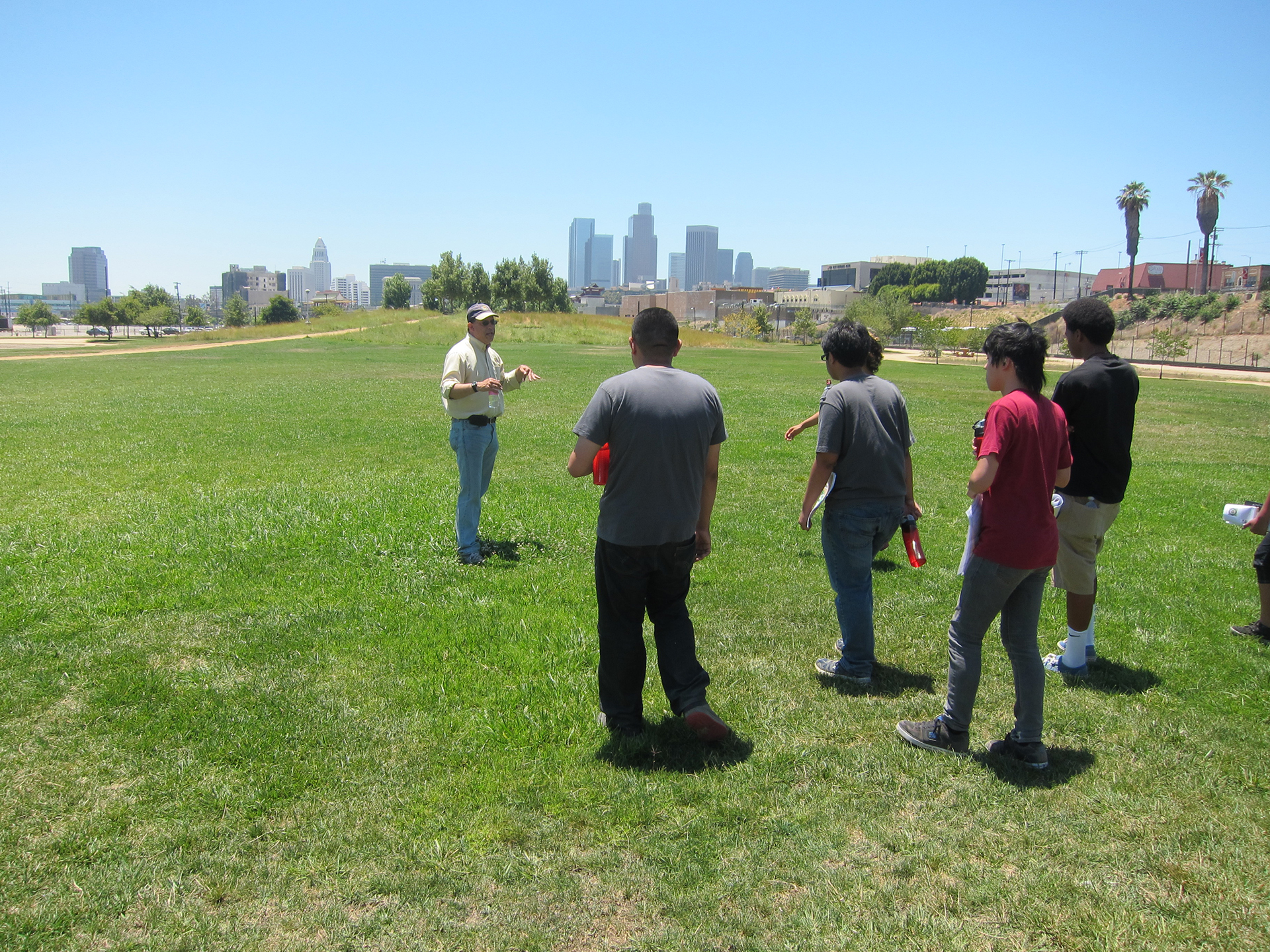
Sean Woods, CA State Parks Superintendent – An Introduction to LASHP
Through IMLab I was able to work with other students from the Los Angeles area with diverse backgrounds. We used different forms of technology in order to find new creative ways for the diverse communities surrounding the Los Angeles State Historic Park to use the park efficiently and learn about its cultural history and its importance to Los Angeles.
–Miriam Rosas, IMLab Summer 2012 Student
ENGAGEMENT
Over the six weeks, students worked on individual and group projects and gained a greater understanding of and connection to LA by:
- Learning basic research methods (distinct methodologies and data collection, data visualization; systems thinking, computational learning);
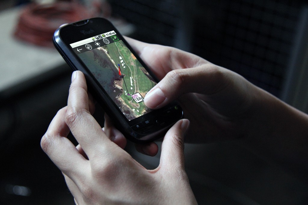
- Familiarizing themselves with participatory sensing through mobile devices and Ohmage, an open-source participatory sensing technology platform;
- Gaining exposure to place-related topics (LASHP and adjacent neighborhood histories, racial and cultural narratives, migratory patterns, urban planning, social activism, environmental justice);
- Utilizing artistic media such as video and audio production, performance, mural design and painting;
- Creating an immersive, culminating site-specific installation and exhibition at IMLab.

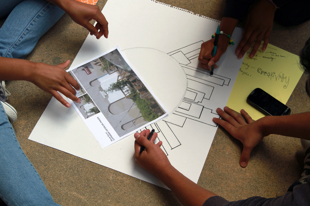
PROJECTS
FutureMe Bios
FutureMe is an exercise designed to build self-esteem and promote agency. Students projected their aspirations over the next quarter century and mapped out how they would achieve them. Each student took her/his turn in front of the camera, sketching out her/his 25-year trajectory in the span of 60-videotaped seconds. A FutureMe video compilation was featured in IMLab’s final exhibition.
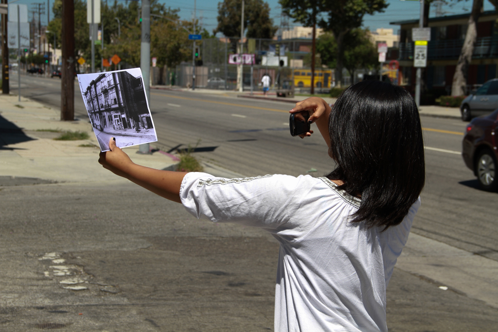
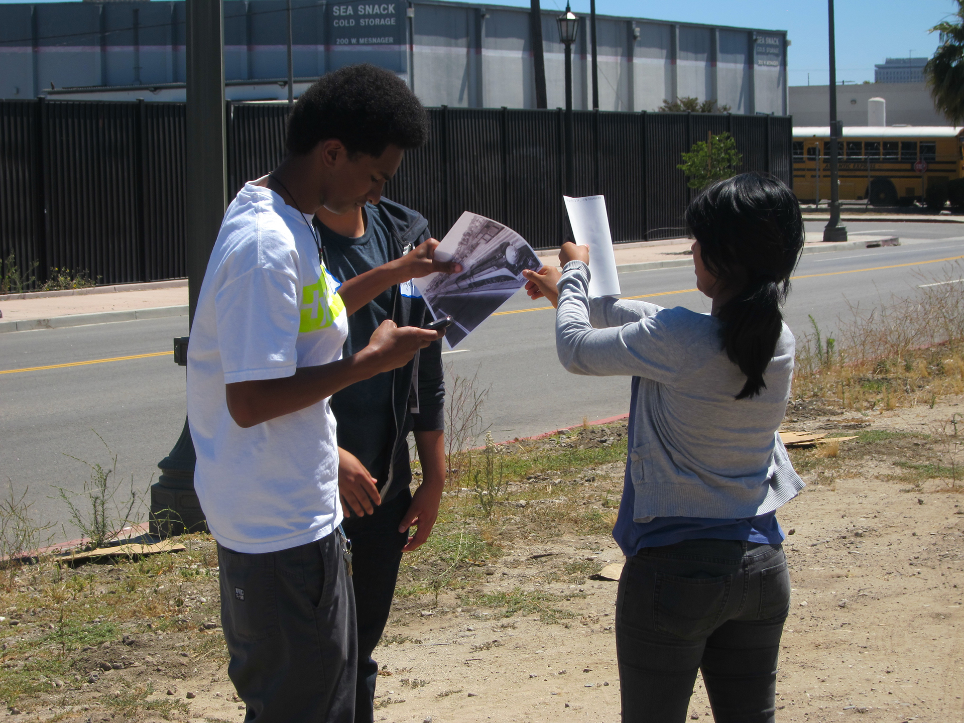
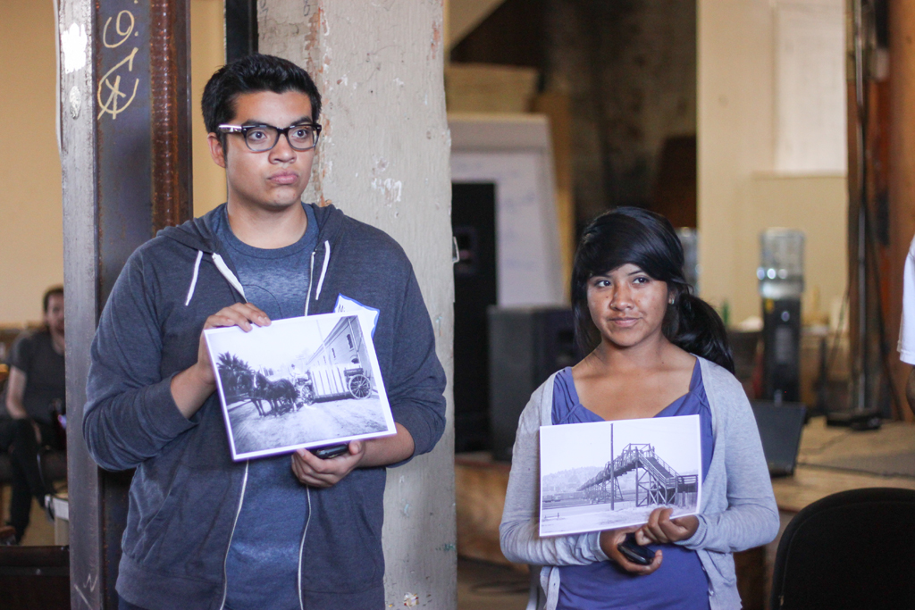
Dear Photograph: Connecting LASHP’s Past to its Present
FutureMe is an exercise designed to build self-esteem and promote agency. Students projected their aspirations over the next quarter century and mapped out how they would achieve them. Each student took her/his turn in front of the camera, sketching out her/his 25-year trajectory in the span of 60-videotaped seconds. A FutureMe video compilation was featured in IMLab’s final exhibition.
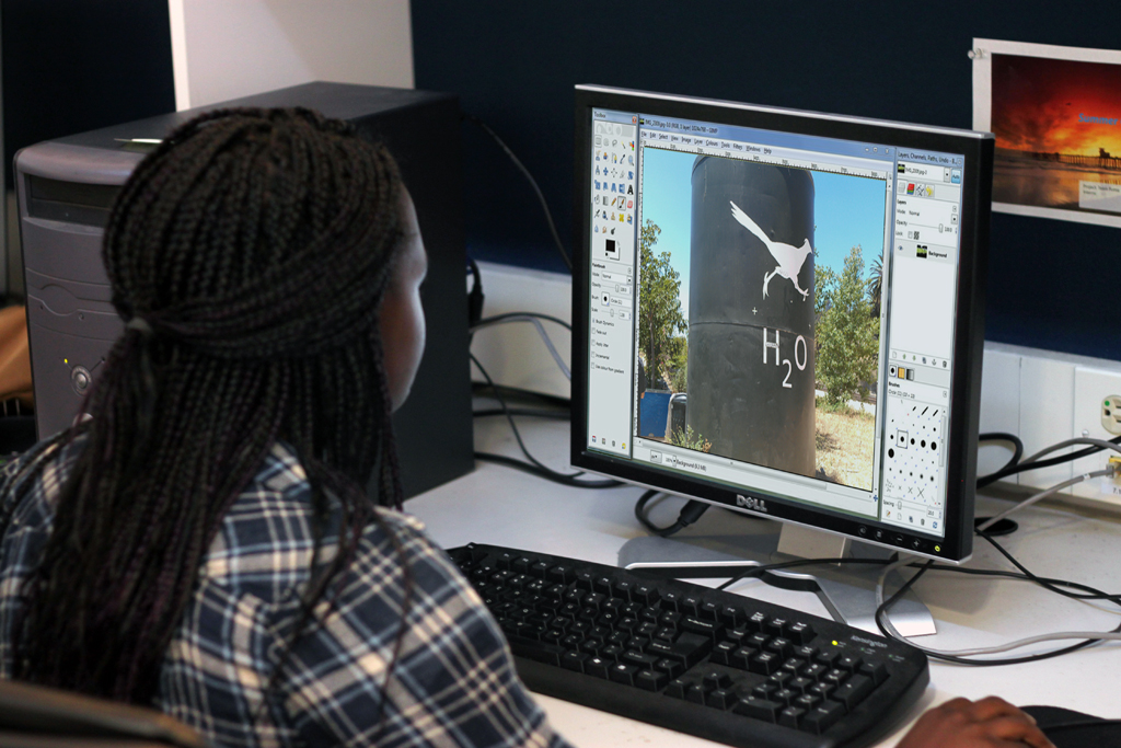
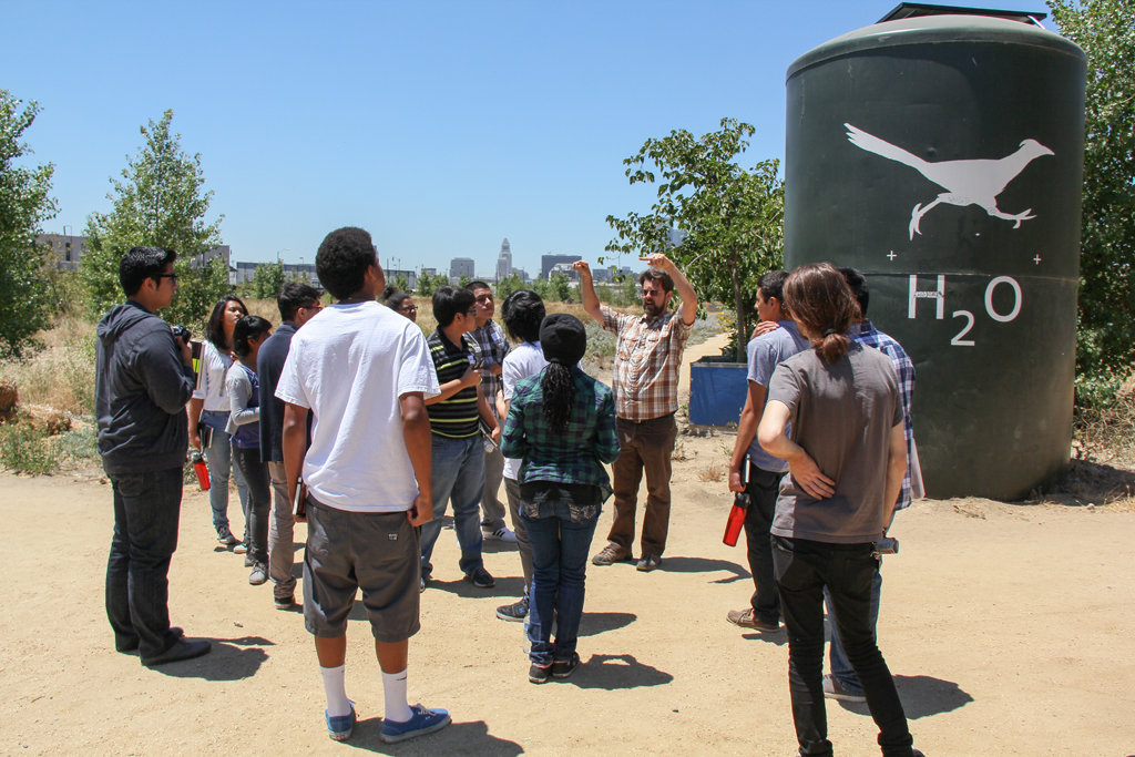

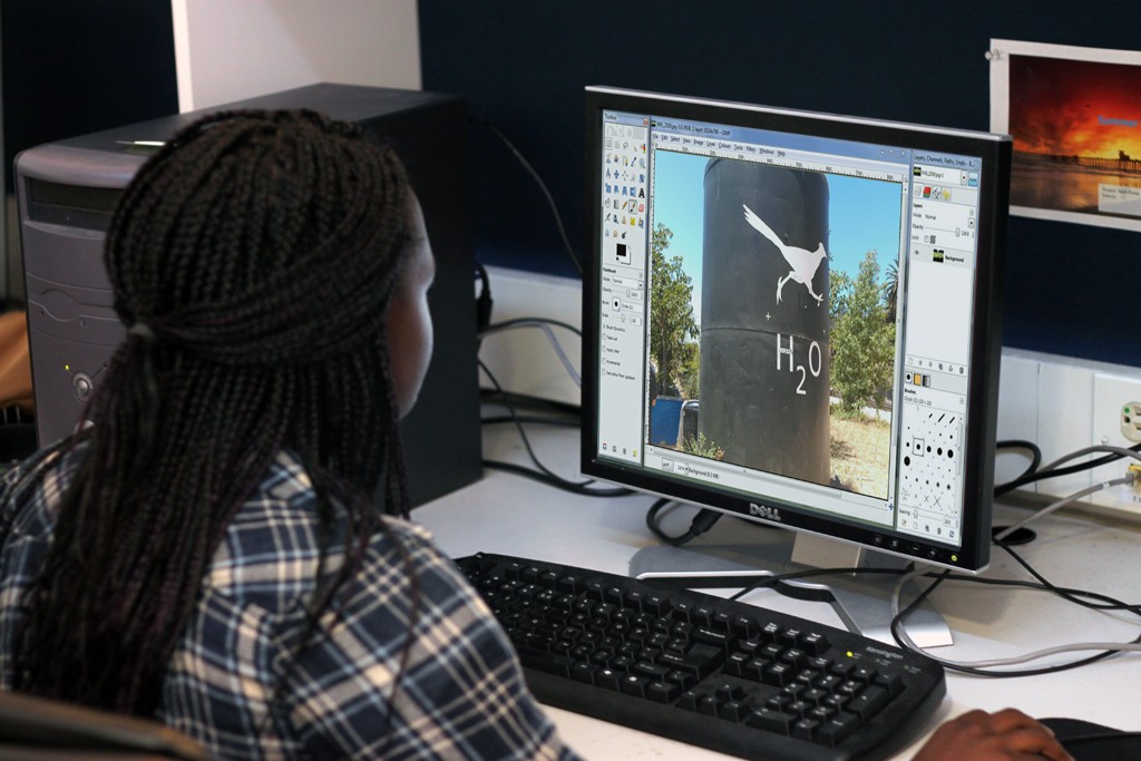
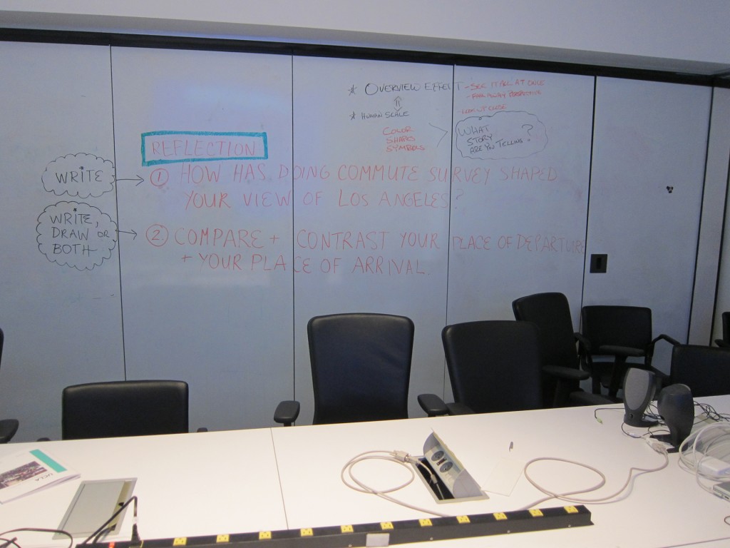
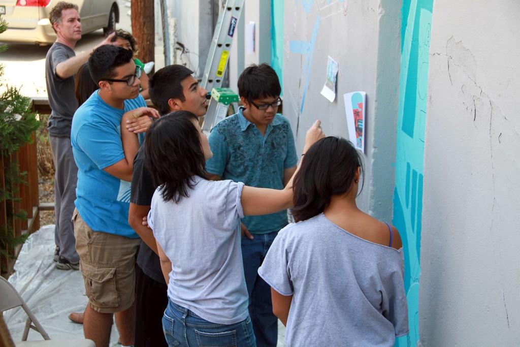
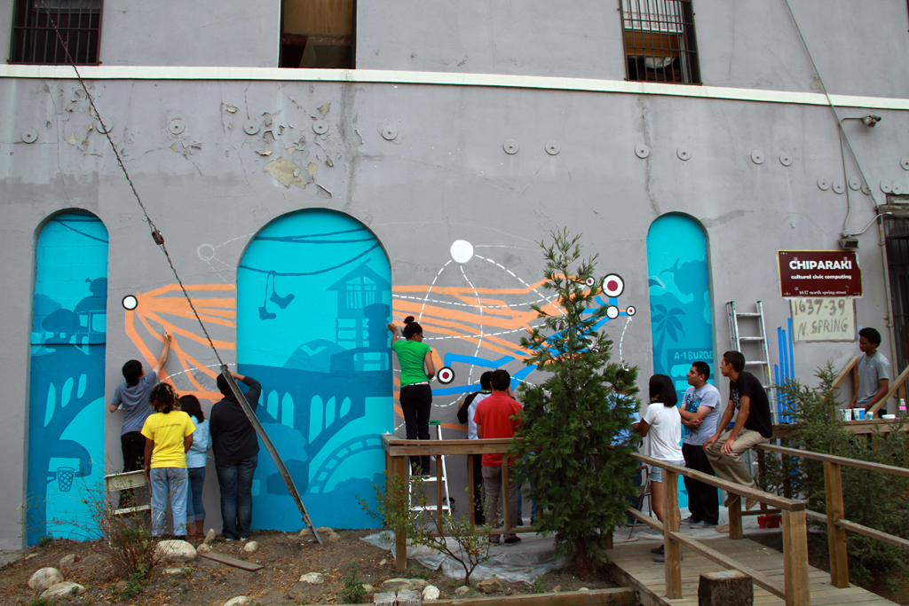
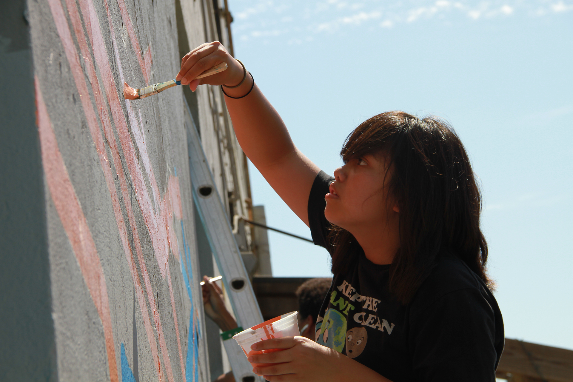
The IMLab Chiparaki Mural: Collective Data Visualization as Mural
Using Ohmage, an open-source participatory sensing technology platform, IMLab students traced and documented their commute between home and both IMLab and UCLA. Data from their routes and iconography representative of the Los Angeles landscape they traversed became source material for a large, highly visible graphic mural on the exterior of IMLab’s building.
Fabric Train Video: Excavating History
Using Ohmage, an open-source participatory sensing technology platform, IMLab students traced and documented their commute between home and both IMLab and UCLA. Data from their routes and iconography representative of the Los Angeles landscape they traversed became source material for a large, highly visible graphic mural on the exterior of IMLab’s building.
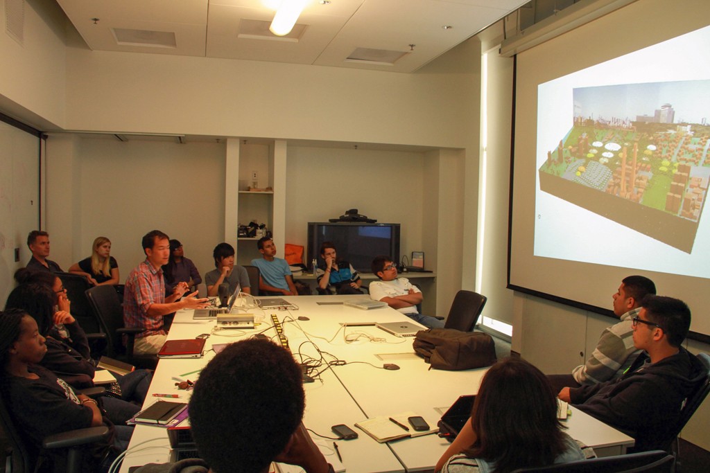
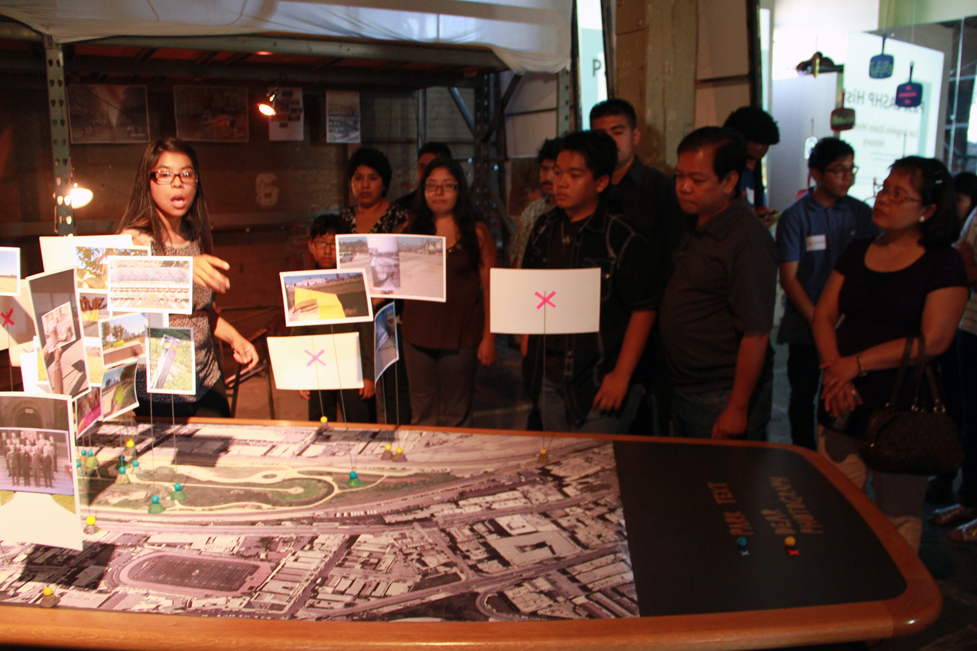
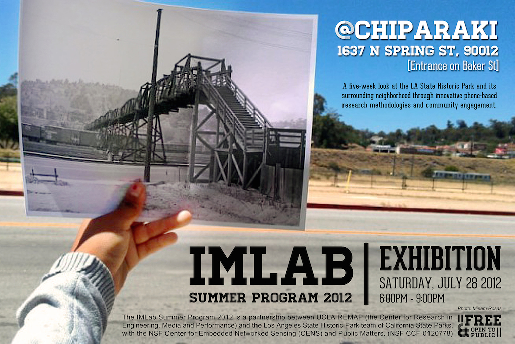
Final Exhibition at IMLab
IMLab students created three site-specific installations for a culminating exhibition about LASHP and surrounding communities. The installations also highlighted the technology skills and software students learned over the summer.
- Time Machine: An interactive environment exploring LASHP’s past, present and future using Microsoft Kinect, FAAST Skeletal Articulation Kit, Prezi, Video Editing and XML Surveys
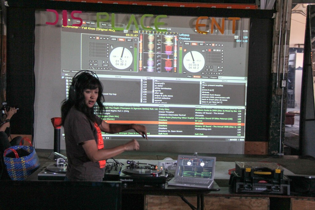
- Displacement Trilogy: A video game exploring Surrounding Communities Around LASHP via sound design using Abelton, Google Earth, Game Editor, Geosetter and GIMP
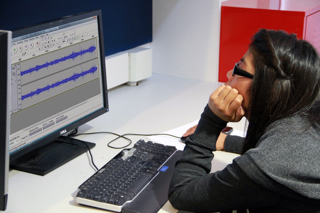
- Spikewave: Making use of their data capture and visualization skills, a piece about LASHP’s Impact on health and safety utilized audio field recordings, Audacity, Tableau and Deducer
IMPACT & LEGACY
Education
- Exposed IMLab students to the community and cultural history of Los Angeles and LASHP and its surrounding communities. For most, this was the first time they learned about how cities grow, how policies and decisions are made, how immigration and migration shaped Los Angeles.
- Developed creative, critical thinking and interpretative skills
- Taught students about data capture using mobile devices, data interpretation and data visualization
- Emphasized collaborative, team-building skills and working in groups
- Heightened students’ sense of self-esteem and confidence
- Introduced students to multiple career and educational pathways
- Introduced and exposed students to numerous visual, analytical, and interpretive media and technologies
Skills
- Audio and Video Production and Post-Production
- Data Mapping
- Data Visualization
- Exhibition Design
- Historical Research and Use of Historical Images
- Mobile, Digital Technologies students used included:
- Abelton
- Adobe Photoshop
- Audacity
- Basic coding
- Deducer
- Game Editor
- Geosetter
- GIMP
- Google Earth
- Ohmage
- Tableau
- Mural Design and Painting
- Statistical Analysis
- Turntabling and Beat Mixing
